-
About
Divisional Introduction
History-Culture
Geographical & Economics
-
Administration
Divisional Commissioner
Office of the Divisional Commissioner
Officer & Staffs
Officers of Field Administrations
-
Government Office
Security & Discipline affairs
Education & Culture
Agriculture & Food affairs
-
Divisional Office(Jute)
-
Barishal Forest Department
-
Divisional Agriculture Marketing Office
-
Barisal region, Agriculture Extension Dept.
-
Divisional Livestock office
-
Divisional Fisheries office
-
Regional Food Controller Office
-
Department of Food
-
Soil Resources Development Institute, Regional Office, Barisal
-
Soil Resources Development Institute, Regional Laboratory, Barisal
-
Regional Seed Certification Office, Seed Certification Agency, Barisal
Health Affairs
Land & Tax
Engineering
ICT
অন্যান্য সরকারী অফিস
-
DSS,Divisional Office
-
Regional Training Center, Department of Social Services
-
Divisional Cooperative Office
-
Divisional Statistics Office, Barisal
-
Office of the Regional Director, Directorate of Technical Education, Barishal Division
-
Controller of Accounts
-
Department of Youth Development
-
National Consumer Rights Protection Department, Barisal Division
-
Public Library, Barisal
-
National Savings Divisional Office, Barisal
-
Divisional Office(Jute)
- Local Government
-
Other institutions
Educational Institutions
Organization
-
Date of Revenue Case
Case information
- Gallery
- Job Corner
-
About
Divisional Introduction
History-Culture
Geographical & Economics
District administration under jurisdiction
other
-
Administration
Divisional Commissioner
Office of the Divisional Commissioner
Add Divisional Commissioner
Officer & Staffs
Officers of Field Administrations
-
Government Office
Security & Discipline affairs
Education & Culture
Agriculture & Food affairs
- Divisional Office(Jute)
- Barishal Forest Department
- Divisional Agriculture Marketing Office
- Barisal region, Agriculture Extension Dept.
- Divisional Livestock office
- Divisional Fisheries office
- Regional Food Controller Office
- Department of Food
- Soil Resources Development Institute, Regional Office, Barisal
- Soil Resources Development Institute, Regional Laboratory, Barisal
- Regional Seed Certification Office, Seed Certification Agency, Barisal
Health Affairs
Land & Tax
Engineering
ICT
অন্যান্য সরকারী অফিস
- DSS,Divisional Office
- Regional Training Center, Department of Social Services
- Divisional Cooperative Office
- Divisional Statistics Office, Barisal
- Office of the Regional Director, Directorate of Technical Education, Barishal Division
- Controller of Accounts
- Department of Youth Development
- National Consumer Rights Protection Department, Barisal Division
- Public Library, Barisal
- National Savings Divisional Office, Barisal
-
Local Government
Director, Local Government
-
Other institutions
Educational Institutions
Organization
-
Date of Revenue Case
Case information
-
Gallery
Pictures of various events
-
Job Corner
Job Corner
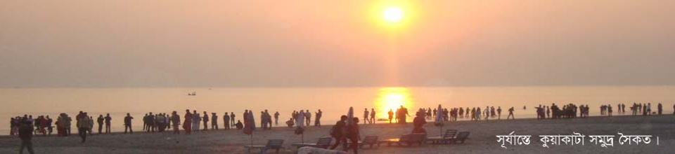
The history of Greater Barisal is, in a way, the history of the rivers and canals of this region. The numerous rivers spread like a net throughout the area have been busy building and breaking this southern part of Bangladesh since prehistoric times, constantly creating new history. From ancient times to the present, the rivers flowing in this region have been in a constant process of creation and destruction. The age of the land called Chandradwip-Bakla is only around fifty thousand years. Since the beginning of its creation, this land has repeatedly changed its form through building and breaking. And that is why there are differences in the landforms of different regions of Chandradwip-Bakla.
The present-day regions of Goura Nadi, Ujirpur, Banaripara, Swarupkathi, Hijla, Muladi, Mehendiganj, Nalchiti, Jhalakati, Betagi, Rajapurkaukhali, Bhandaria, Pirojpur, Nazirpur, Mirjaganj, Baufal, Borhanuddin, etc. are among the first-stage landforms of Barisal.
The list of landforms created in the second stage includes Kanthalia, Amtali, Galachipa and Daulatkhan.
The process of land formation of Barguna, Patharghata, Khepupara and Manpura was completed in the third stage.
The places of the landforms created in the second and third stages have continued to play a special role in the formation of new landforms by participating in the process of breaking and building. And in view of that, various changes are taking place in the low plains of the Barisal region. This ongoing process of land growth has turned Greater Barisal into an active delta.
Geographical location: Barisal district is located at 220 42' 0'' north latitude and 900 22' 0'' east longitude.
Area: The total area of the district is 2,791 square kilometers.
Boundaries: Barisal district is bounded by Chandpur, Madaripur and Shariatpur districts to the north; Jhalakati, Barguna and Patuakhali districts to the south; Lakshmipur district and the Meghna River to the east and Pirojpur, Jhalakati and Gopalganj districts to the west.
Population: The population of the district (according to the 2011 census) is 93 lakh 25 thousand 771 people.
Source: History of Barisal, Saiful Ahsan Bulbul, Gatidhara, Dhaka, April 2009 and Bangladesh Bureau of Statistics.


Planning and Implementation: Cabinet Division, A2I, BCC, DoICT and BASIS
Technical Assistance:
![]()
Developed By: